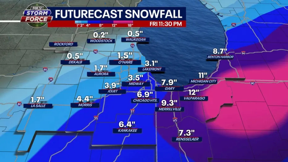
Remember when it was warm earlier this week? Forget that. “Spring snow” is on the way as Friday morning, a wintery mix is headed for the Windy City. Per FOX 32, the GFS model squeezes out a wide range of snow from as little as a dusting well northwest of Chicago to around 3-4 inches in the city. The heaviest snow is south and east of Chicago where up to a half foot to a foot could come down.

Hopefully this is the last big snowfall we see this year, with baseball and summer fun on the horizon.


